
📋 Table of contents
- What is Google Earth Engine ?
- What is cptcity and why ?
- Top of the cpt palettes
- Calling module and use it!
- Examples
🔴 1. What is Google Earth Engine ?
 Google Earth Engine is a cloud-based platform that helps access high-performance
computing resources for processing and analyzing large geospatial datasets (Noel
Golerick et al.,2017).
Google Earth Engine is a cloud-based platform that helps access high-performance
computing resources for processing and analyzing large geospatial datasets (Noel
Golerick et al.,2017).
🔴 2. What is cptcity and why ?
Cptcity is a solium platform where you can find multiple colour palettes for various themes related to cartography, technical illustration and design. The archive supports various formats and is organised by author. Cptcity currently has colour palettes for the most popular desktop Geographic Information Systems such as QGIS, GRASS , SAGA , ARCGIS , and others. Currently, it has 7000 colour palettes, however in this second version of ee-cptcity module more than 300 colour palettes were incorporated along with 2 popular palettes like rocket , mako and turbo.
🔴 3. Top of the cpt palettes
The 75 most popular cpt files with the number downloaded shown in parentheses. The arrows indicate the change in rank in the last month. This list is compiled from the files downloaded in the last year (a total of 21,647 files) and is updated irregularly, most recently on 04/03/2022.

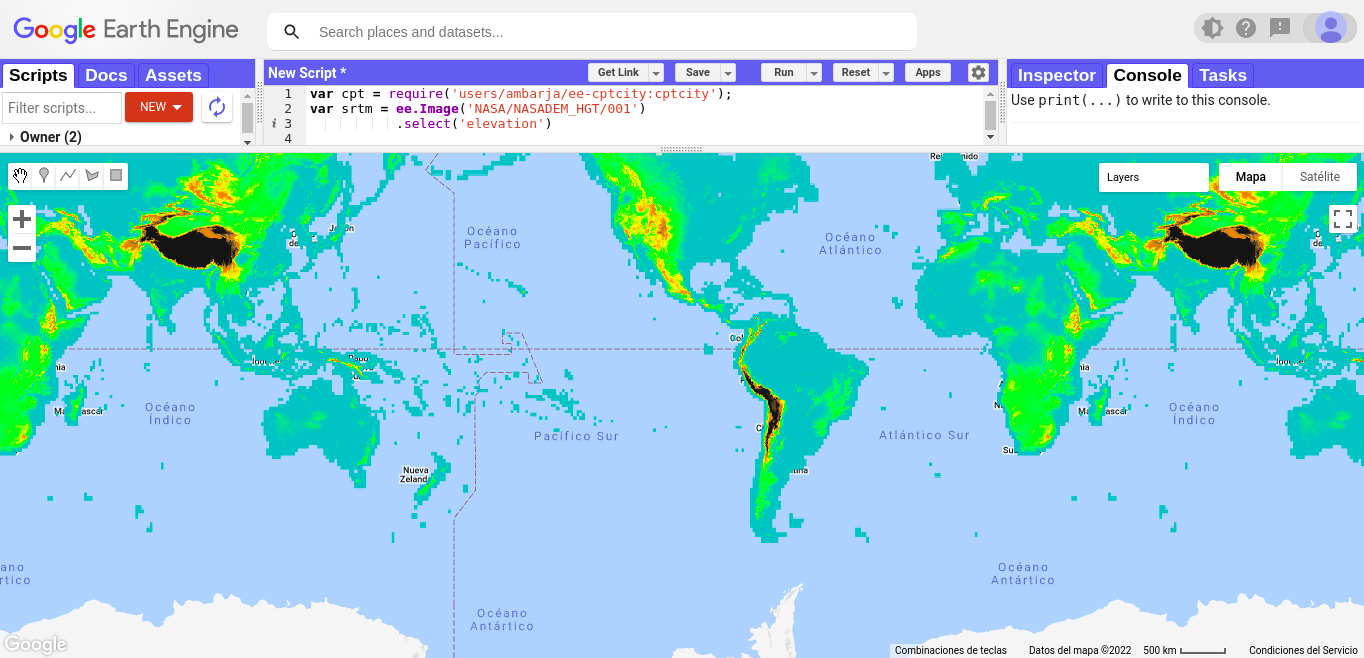
🔴 4. Calling module and use it!
var srtm = ee.Image('NASA/NASADEM_HGT/001')
           .select('elevation')

var viz = {
  min: 400,
  max: 4000,
  palette:cpt.pal.grass_elevation
  };
Map.setZoom(1);
Map.addLayer(srtm,viz,'Elevation(m)');
📚 References
-
David Montero, 2021, ee-pokepalettes, https://github.com/davemlz/ee-pokepalettes
-
Gennadii Donchyts, Fedor Baart & Justin Braaten ,2020,https://github.com/gee-community/ee-palettes
-
Sergio Ibarra Espinosa, 2017, cptcity, https://github.com/ibarraespinosa/cptcity